

A low pressure area (LPA) being monitored east of the country entered the Philippine Area of Responsibility (PAR) on Sunday evening, the state weather bureau said.
As of 8 a.m. Monday, the LPA was located about 1,125 kilometers east of Central Luzon, according to PAGASA.
The LPA has a low chance of developing into a tropical cyclone within the next 24 hours and is not expected to make landfall.
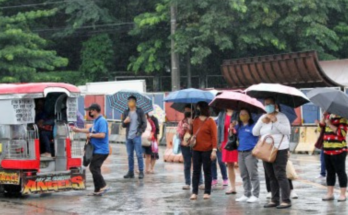
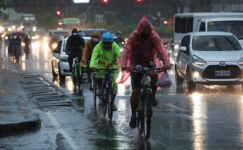
However, its trough or extension will bring rains over Aurora, Quezon, the Bicol Region, and Eastern Visayas on Monday.
The southwest monsoon or habagat will also bring scattered rains to parts of Central and Southern Luzon, the Visayas, Metro Manila, and Mindanao.
The disturbance is projected to remain over waters east of Luzon in the coming days as it slowly organizes. By the weekend, it may begin to move northeastward away from the country.
Should it strengthen into a tropical storm while inside PAR, it will be named Bising. While not expected to directly impact the country, it could enhance habagat or leading to continued rains in the western sections of the country.