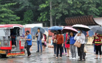

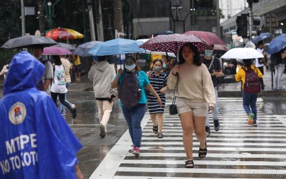
SEVERE Tropical Storm Carina and the southwest monsoon (“habagat”) will bring rains and strong winds over parts of the country on Monday, the weather bureau said.
Carina was last tracked 420 km. east of Tuguegarao City, Cagayan and is almost stationary, packing maximum sustained winds of 100 kph near the center and gustiness of up to 125 kph.
Tropical Cyclone Wind Signal (TCWS) No. 1 has been hoisted over the eastern portion of mainland Cagayan (Santa Ana, Gattaran, Baggao, Peñablanca, Lal-Lo, and Gonzaga) and the northeastern portion of Isabela (Divilacan, Palanan, and Maconacon).
Carina enhances the southwest monsoon, which is forecast to bring moderate to intense rainfall over various localities in the western portion of Luzon on Monday night through Wednesday.
The southwest monsoon will cause strong to gale-force gusts over Mimaropa, Bicol Region, Western Visayas, Northern Samar, and the northern portion of Samar.
Both Carina and the “habagat” will bring moderate to rough seas over the northern and eastern seaboards of Northern Luzon.
The Philippine Atmospheric, Geophysical and Astronomical Services Administration (PAGASA) advised mariners of small seacraft, including all types of motorbancas, not to venture to the sea.
Moderate seas will prevail over the seaboards of Central and Southern Luzon and the eastern seaboards of the Visayas and Mindanao. Mariners of motorbancas and similarly-sized vessels were advised to take precautionary measures while venturing out to sea and, if possible, avoid navigating under these conditions.
Meanwhile, PAGASA said Carina will remain far from the landmass, and could exit the Philippine Area of Responsibility either Wednesday night or Thursday.
However, Carina could steadily intensify in the next four days, and could reach the typhoon category within 24 hours. (PNA)