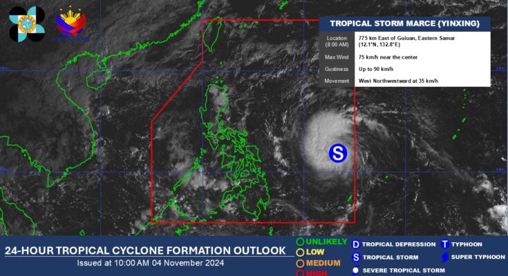
A Tropical Storm (international name Yinxing), the 13th tropical cyclone, to enter the Philippine Area of Responsibility (PAR) was given the local name Marce, the weather bureau said Monday.
In its 5 a.m. bulletin, the Philippine Atmospheric, Geophysical and Astronomical Services Administration (PAGASA) said Marce, entered PAR at 4 a.m., packing maximum sustained winds of 65 km per hour (kph) near the center and gusts of up to 80 kph.
It was located at 935 km. east of Eastern Visayas as of 4 a.m.
No tropical cyclone wind signal (TCWS) is hoisted on any part of the country but the hoisting of TCWS No. 1 over portions of Cagayan on Tuesday is possible.
Marce moving northwest could enhance the northeasterly wind flow this week.
On Monday, PAGASA forecasted the northeasterly wind flow to bring gale-force gusts across Batanes, Cagayan including Babuyan Islands, Isabela, Ilocos Norte, Aurora, and the northern portion of Quezon.
Rough seas may be experienced over the seaboards of Batanes and Ilocos Norte.
Mariners of small sea vessels, including all motor bancas, are advised not to venture out to the sea.
The cyclone’s trough could cause rains over extreme Northern Luzon and the eastern section of Luzon beginning Tuesday.
Meanwhile, PAGASA said Marce’s forecast track is highly uncertain. The cyclone could either move west toward extreme northern Luzon or mainland Luzon or move erratically over the Philippine Sea east of extreme northern Luzon.
“A westward shift in track is likely within the next 24 hours due to the high-pressure area north of Marce. As such, the landfall scenario may change from Babuyan Islands down to Isabela area,” PAGASA said.
The cyclone is expected to intensify and could reach the typhoon category on Wednesday, PAGASA said. (PNA)


